Show the map
N.-D. de la Gorge - Lacs Jovet - Le Pain de Sucre
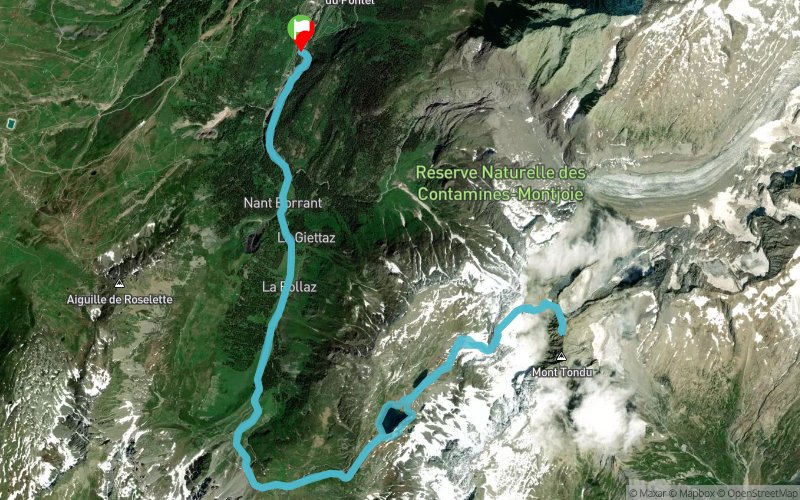


24.8 km
2310 m
2310 m
 Notre Dame des Gorges (74)
 Points of Interest table
| Accum. | Intermediary | |||||||
|---|---|---|---|---|---|---|---|---|
| POI | Description | Alt. | Dist. | D+ | D- | Dist. | D+ | D- |
Trace n°98558
Ascent threshold : 5 m Distance threshold : 10 m Smoothing : Yes Origin of altitudes : MNT Aster GDEM
Ascent threshold : 5 m Distance threshold : 10 m Smoothing : Yes Origin of altitudes : MNT Aster GDEM
Loop
Dominant terrain : Footpath
Max alti. : 3127 m
Avg alti. : 2054 m
Min alti. : 1209 m
Longest ascent : 2120 m
Longest descent : 2090 m
Route completed by the author : Yes
Dominant terrain : Footpath
Max alti. : 3127 m
Avg alti. : 2054 m
Min alti. : 1209 m
Longest ascent : 2120 m
Longest descent : 2090 m
Route completed by the author : Yes
Elevation profile
More tools
Create a new roadbook page
Map and track on your website
Warning ! When you insert a Trace de Trail map on your website, you agree not to hide any element of the module (links to Trail Trail or Trail Connect banner)
Add a realisation
Validate
Add a realisation to share your chrono and describe the conditions that you encountered during you trail running !
Show the infos
Add a track


