Show the map
Durfort - Gouffre de Malamort - Malcoustat
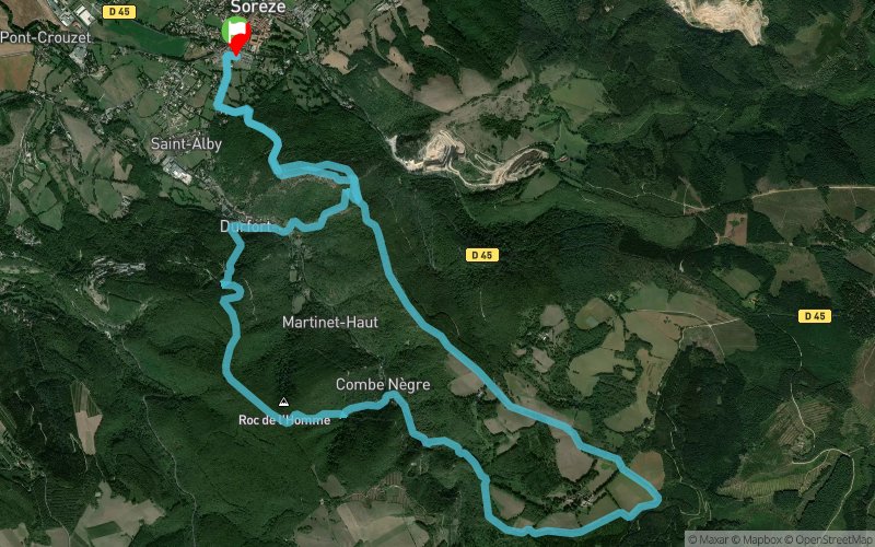


16.3 km
1030 m
1040 m
 Sorèze (81)
 Points of Interest table
| Accum. | Intermediary | |||||||
|---|---|---|---|---|---|---|---|---|
| POI | Description | Alt. | Dist. | D+ | D- | Dist. | D+ | D- |
Trace n°81022
Ascent threshold : 3 m Distance threshold : 30 m Smoothing : No Origin of altitudes : MNT Aster GDEM
Ascent threshold : 3 m Distance threshold : 30 m Smoothing : No Origin of altitudes : MNT Aster GDEM
Loop
Dominant terrain : Footpath
Max alti. : 680 m
Avg alti. : 493 m
Min alti. : 255 m
Longest ascent : 370 m
Longest descent : 450 m
Route completed by the author : Yes
Dominant terrain : Footpath
Max alti. : 680 m
Avg alti. : 493 m
Min alti. : 255 m
Longest ascent : 370 m
Longest descent : 450 m
Route completed by the author : Yes
Elevation profile
More tools
Create a new roadbook page
Map and track on your website
Warning ! When you insert a Trace de Trail map on your website, you agree not to hide any element of the module (links to Trail Trail or Trail Connect banner)
Add a realisation
Validate
Add a realisation to share your chrono and describe the conditions that you encountered during you trail running !
Add a comment
Validate
Laurieanne04
17/05/20, 22:21:51
Trace suivie. A éviter après de fortes pluies ou après 1 semaine de précipitation ( rivières à traverser, pierres glissantes à escalader, et descentes à pics glissantes. A refaire au sec car trace sympa !
17/05/20, 22:21:51
Trace suivie. A éviter après de fortes pluies ou après 1 semaine de précipitation ( rivières à traverser, pierres glissantes à escalader, et descentes à pics glissantes. A refaire au sec car trace sympa !
Show the infos
Add a track


