Show the map
Bois de St-Antoine - La Jayère - Pont Baillardon - Bois des Buissées
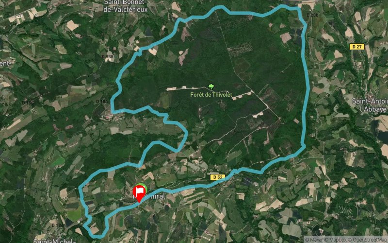


22.9 km
590 m
590 m
 Montmiral (26)
 Montmiral (26)
 Points of Interest table
| Accum. | Intermediary | |||||||
|---|---|---|---|---|---|---|---|---|
| POI | Description | Alt. | Dist. | D+ | D- | Dist. | D+ | D- |
Trace n°79770
Ascent threshold : 3 m Distance threshold : 30 m Smoothing : Yes Origin of altitudes : MNT Aster GDEM
Ascent threshold : 3 m Distance threshold : 30 m Smoothing : Yes Origin of altitudes : MNT Aster GDEM
Loop
Dominant terrain : Path
Max alti. : 565 m
Avg alti. : 486 m
Min alti. : 348 m
Longest ascent : 130 m
Longest descent : 170 m
Route completed by the author : Yes
Dominant terrain : Path
Max alti. : 565 m
Avg alti. : 486 m
Min alti. : 348 m
Longest ascent : 130 m
Longest descent : 170 m
Route completed by the author : Yes
Elevation profile
More tools
Create a new roadbook page
Map and track on your website
Warning ! When you insert a Trace de Trail map on your website, you agree not to hide any element of the module (links to Trail Trail or Trail Connect banner)
Add a realisation
Validate
Add a realisation to share your chrono and describe the conditions that you encountered during you trail running !
Add a comment
Validate
Admin - Trace de Trail
18/02/19, 20:56:57
Bonjour, Les randonnées ne peuvent être classées en compétition que si elles sont rattachées à une compétition de trail (ce qui doit apparaître dans le nom). Merci de corriger.
18/02/19, 20:56:57
Bonjour, Les randonnées ne peuvent être classées en compétition que si elles sont rattachées à une compétition de trail (ce qui doit apparaître dans le nom). Merci de corriger.
Show the infos
Add a track


