Show the map
Certified Track - ITRA
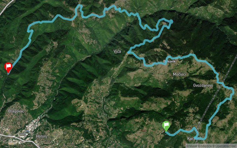
Skakavac Trail 2018 - 32 km


 Inconnu (BA)
 Inconnu (BA)


On this course you will feel real charms and temptations of trail running. The start is at the beautiful Sarajevo resort of ?avljak at 1000 meters above sea level. This viewpoint is located at 9 kilometers from Baš?aršija, with enticing unique view of Šeher. Over the Sarajevo Ozren, Crepoljsko and Bukovik peaks, trail course enters the protected natural area, and all along the way passing through the areas of eye-catching beauty. On this part of the course, it is quite normal, in mid-summer, to have all four seasons exchange in a very short period of time. Upon arrival at Uževica, it joins the other course and follows the path near waterfall Skakavac.
Points of Interest table
| Accum. | Intermediary | |||||||
|---|---|---|---|---|---|---|---|---|
| POI | Description | Alt. | Dist. | D+ | D- | Dist. | D+ | D- |
 Competition organized on 09/29/2018
Trace n°58533
Ascent threshold : 3 m Distance threshold : 0 m Smoothing : No Origin of altitudes : GPS + MNT Aster GDEM
Ascent threshold : 3 m Distance threshold : 0 m Smoothing : No Origin of altitudes : GPS + MNT Aster GDEM
Crossing
Dominant terrain : Path
Max alti. : 1523 m
Avg alti. : 1144 m
Min alti. : 626 m
Longest ascent : 410 m
Longest descent : 660 m
Dominant terrain : Path
Max alti. : 1523 m
Avg alti. : 1144 m
Min alti. : 626 m
Longest ascent : 410 m
Longest descent : 660 m
Elevation profile
More tools
Create a new roadbook page
Map and track on your website
Warning ! When you insert a Trace de Trail map on your website, you agree not to hide any element of the module (links to Trail Trail or Trail Connect banner)
Add a realisation
Validate
Add a realisation to share your chrono and describe the conditions that you encountered during you trail running !
Add a comment
Validate
Show the infos
Add a track


