Show the map
Evaluated Track - ITRA
Ultra Trail Naut Aran 2018
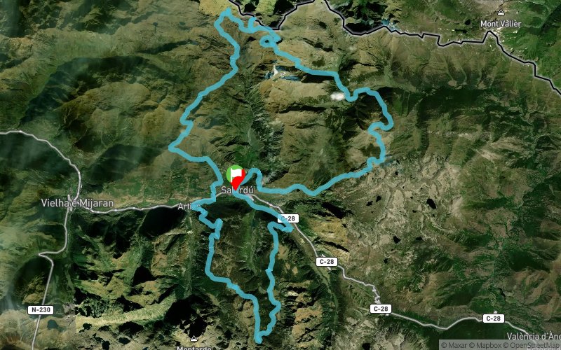


 Salardu (ES)


The Ultra Trail Naut Aran is a mountain race that runs along trails, tracks and alpine meadows that cross part of the Lleida Pyrenees. Part of this tour is technical, with unexpected slopes, both up and down. The route of the Ultra Trail is approximately 86 kilometers, with 5,500 meters of positive height gain and 5,500 meters of negative height, depending on the accuracy of the GPS used (recording with Garmin eTrex10, analysis with Land). We consider it to be semi-self-sufficient, since its participants will have to go well provisioned, because in some occasions the distances between refreshments are close to 10 kilometers.
Points of Interest table
| Accum. | Intermediary | |||||||
|---|---|---|---|---|---|---|---|---|
| POI | Description | Alt. | Dist. | D+ | D- | Dist. | D+ | D- |
 Competition organized on 08/04/2018
Trace n°49239
Ascent threshold : 3 m Distance threshold : 0 m Smoothing : No Origin of altitudes : GPS
Ascent threshold : 3 m Distance threshold : 0 m Smoothing : No Origin of altitudes : GPS
Loop
Dominant terrain : Footpath
Max alti. : 2879 m
Avg alti. : 2007 m
Min alti. : 1141 m
Longest ascent : 1210 m
Longest descent : 1420 m
Dominant terrain : Footpath
Max alti. : 2879 m
Avg alti. : 2007 m
Min alti. : 1141 m
Longest ascent : 1210 m
Longest descent : 1420 m
Elevation profile
More tools
Create a new roadbook page
Map and track on your website
Warning ! When you insert a Trace de Trail map on your website, you agree not to hide any element of the module (links to Trail Trail or Trail Connect banner)
Add a realisation
Validate
Add a realisation to share your chrono and describe the conditions that you encountered during you trail running !
Add a comment
Validate
Show the infos
Add a track


