Show the map
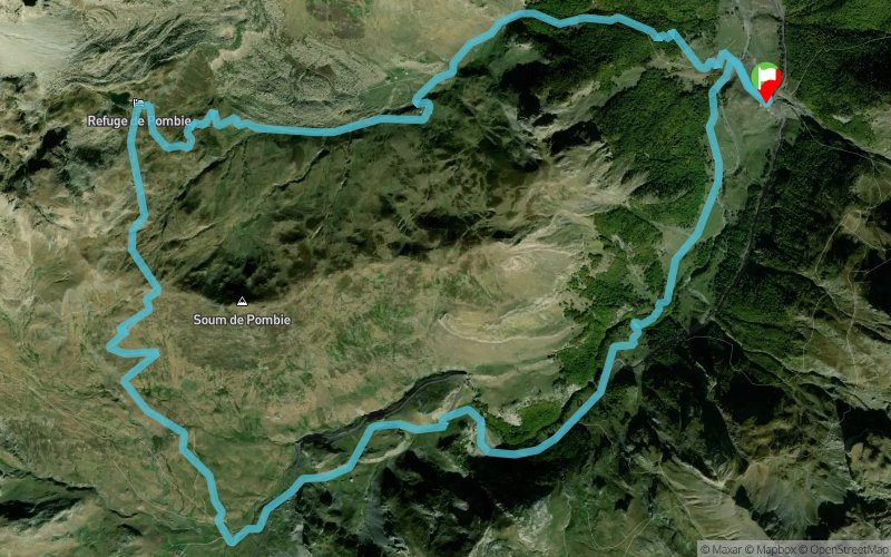
Caillou de Soques - Refuge de Pombie


 Formigal (ES)
 Points of Interest table
| Accum. | Intermediary | |||||||
|---|---|---|---|---|---|---|---|---|
| POI | Description | Alt. | Dist. | D+ | D- | Dist. | D+ | D- |
Trace n°42869
Ascent threshold : 3 m Distance threshold : 30 m Smoothing : Yes Origin of altitudes : MNT Aster GDEM
Ascent threshold : 3 m Distance threshold : 30 m Smoothing : Yes Origin of altitudes : MNT Aster GDEM
Loop
Dominant terrain : Footpath
Max alti. : 2112 m
Avg alti. : 1688 m
Min alti. : 1344 m
Longest ascent : 780 m
Longest descent : 850 m
Route completed by the author : Yes
Dominant terrain : Footpath
Max alti. : 2112 m
Avg alti. : 1688 m
Min alti. : 1344 m
Longest ascent : 780 m
Longest descent : 850 m
Route completed by the author : Yes
Elevation profile
More tools
Create a new roadbook page
Map and track on your website
Warning ! When you insert a Trace de Trail map on your website, you agree not to hide any element of the module (links to Trail Trail or Trail Connect banner)
Add a realisation
Validate
Add a realisation to share your chrono and describe the conditions that you encountered during you trail running !
Add a comment
Validate
Le-Bouquetin-Boiteux
21/08/17, 15:41:38
Plus d'infos : http://gump-blog.blogspot.fr/2017/08/refuge-de-pombie-caillou-de-soques-en.html
21/08/17, 15:41:38
Plus d'infos : http://gump-blog.blogspot.fr/2017/08/refuge-de-pombie-caillou-de-soques-en.html
Show the infos
Add a track


