Show the map
La Bérarde - Ref. du Châtelleret - Ref. du Pavé - Ref. de l'Alpe de Villar-d'Arêne
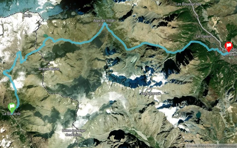


31.4 km
2260 m
2490 m
 Saint-Christophe-en-Oisans (38)
 Le Monêtier-les-Bains (05)
 Points of Interest table
| Accum. | Intermediary | |||||||
|---|---|---|---|---|---|---|---|---|
| POI | Description | Alt. | Dist. | D+ | D- | Dist. | D+ | D- |
Trace n°40533
Ascent threshold : 3 m Distance threshold : 30 m Smoothing : Yes Origin of altitudes : MNT Aster GDEM
Ascent threshold : 3 m Distance threshold : 30 m Smoothing : Yes Origin of altitudes : MNT Aster GDEM
Crossing
Dominant terrain : Footpath
Max alti. : 3157 m
Avg alti. : 2128 m
Min alti. : 1461 m
Longest ascent : 950 m
Longest descent : 1000 m
Route completed by the author : nc
Dominant terrain : Footpath
Max alti. : 3157 m
Avg alti. : 2128 m
Min alti. : 1461 m
Longest ascent : 950 m
Longest descent : 1000 m
Route completed by the author : nc
Elevation profile
More tools
Create a new roadbook page
Map and track on your website
Warning ! When you insert a Trace de Trail map on your website, you agree not to hide any element of the module (links to Trail Trail or Trail Connect banner)
Add a realisation
Validate
Add a realisation to share your chrono and describe the conditions that you encountered during you trail running !
Add a comment
Validate
Show the infos
Add a track


