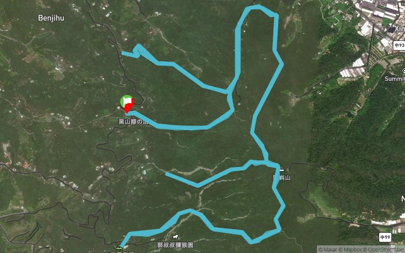
Show the map
Certified Track - ITRA
Night Trail Running of Taichung Dakeng 2017 - Sunrise


 Inconnu (TW)


To promote Trial of Taichung DaKeng beautiful scenery, watch the night view of Taichung.
To promote environmental Ultra Trail, self supply ultra trail running culture.
Points of Interest table
| Accum. | Intermediary | |||||||
|---|---|---|---|---|---|---|---|---|
| POI | Description | Alt. | Dist. | D+ | D- | Dist. | D+ | D- |
 Competition organized on 11/18/2017
Trace n°40244
Ascent threshold : 10 m Distance threshold : 0 m Smoothing : No Origin of altitudes : GPS
Ascent threshold : 10 m Distance threshold : 0 m Smoothing : No Origin of altitudes : GPS
Loop
Dominant terrain : Path
Max alti. : 862 m
Avg alti. : 652 m
Min alti. : 422 m
Longest ascent : 450 m
Longest descent : 390 m
Dominant terrain : Path
Max alti. : 862 m
Avg alti. : 652 m
Min alti. : 422 m
Longest ascent : 450 m
Longest descent : 390 m
Elevation profile
More tools
Create a new roadbook page
Map and track on your website
Warning ! When you insert a Trace de Trail map on your website, you agree not to hide any element of the module (links to Trail Trail or Trail Connect banner)
Add a realisation
Validate
Add a realisation to share your chrono and describe the conditions that you encountered during you trail running !
Add a comment
Validate
Show the infos
Add a track


