Show the map
Le Freyssinet - Le Grand Aréa A/R
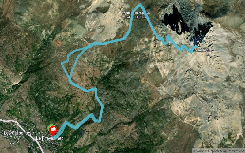


14.4 km
1420 m
1426 m
 Le Monêtier-les-Bains (05)
 Le Monêtier-les-Bains (05)
 Points of Interest table
| Accum. | Intermediary | |||||||
|---|---|---|---|---|---|---|---|---|
| POI | Description | Alt. | Dist. | D+ | D- | Dist. | D+ | D- |
Trace n°3892
Ascent threshold : 0 m Distance threshold : 35 m Smoothing : Yes Origin of altitudes : MNT Aster GDEM
Ascent threshold : 0 m Distance threshold : 35 m Smoothing : Yes Origin of altitudes : MNT Aster GDEM
Loop
Dominant terrain : Footpath
Max alti. : 2839 m
Avg alti. : 2161 m
Min alti. : 1454 m
Longest ascent : 1421 m
Longest descent : 1403 m
Route completed by the author : nc
Dominant terrain : Footpath
Max alti. : 2839 m
Avg alti. : 2161 m
Min alti. : 1454 m
Longest ascent : 1421 m
Longest descent : 1403 m
Route completed by the author : nc
Elevation profile
More tools
Create a new roadbook page
Map and track on your website
Warning ! When you insert a Trace de Trail map on your website, you agree not to hide any element of the module (links to Trail Trail or Trail Connect banner)
Add a realisation
Validate
Add a realisation to share your chrono and describe the conditions that you encountered during you trail running !
Add a comment
Validate
xROROx
27/07/18, 13:53:34
Bonjour, J'ai suivi la trace jusqu'au Puy Freyssinet, mais il me semble qu'à partir de là la trace coupe tout droit dans l'alpage au lieu de suivre la piste qui monte au col de Buffère.
27/07/18, 13:53:34
Bonjour, J'ai suivi la trace jusqu'au Puy Freyssinet, mais il me semble qu'à partir de là la trace coupe tout droit dans l'alpage au lieu de suivre la piste qui monte au col de Buffère.
Show the infos
Add a track


