Show the map
Evaluated Track - ITRA
2016??????????? 2016 - 2016???????????@???


 Inconnu (CN)


Love country trail running event organizers, it is the national professional running event planning and service platform. For the runners, running groups, sponsors learning, communication and business development opportunities, provide positive energy for the community. Company slogan
Points of Interest table
| Accum. | Intermediary | |||||||
|---|---|---|---|---|---|---|---|---|
| POI | Description | Alt. | Dist. | D+ | D- | Dist. | D+ | D- |
 Competition organized on 01/16/2016
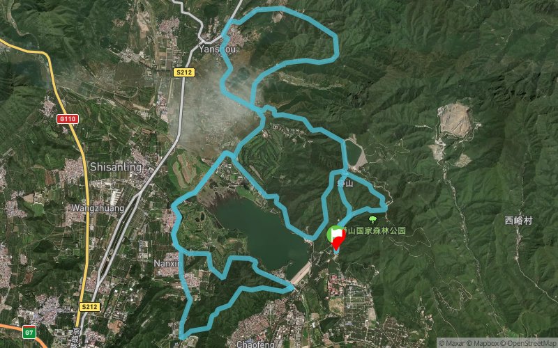
Trace n°17397
Ascent threshold : 3 m Distance threshold : 30 m Smoothing : Yes Origin of altitudes : MNT Aster GDEM
Ascent threshold : 3 m Distance threshold : 30 m Smoothing : Yes Origin of altitudes : MNT Aster GDEM
Loop
Dominant terrain : Road
Max alti. : 622 m
Avg alti. : 203 m
Min alti. : 84 m
Longest ascent : 530 m
Longest descent : 480 m
Dominant terrain : Road
Max alti. : 622 m
Avg alti. : 203 m
Min alti. : 84 m
Longest ascent : 530 m
Longest descent : 480 m
Elevation profile
More tools
Create a new roadbook page
Map and track on your website
Warning ! When you insert a Trace de Trail map on your website, you agree not to hide any element of the module (links to Trail Trail or Trail Connect banner)
Add a realisation
Validate
Add a realisation to share your chrono and describe the conditions that you encountered during you trail running !
Add a comment
Validate
Show the infos
Add a track


