Sur la trace des Chartreux
Add to my favorites


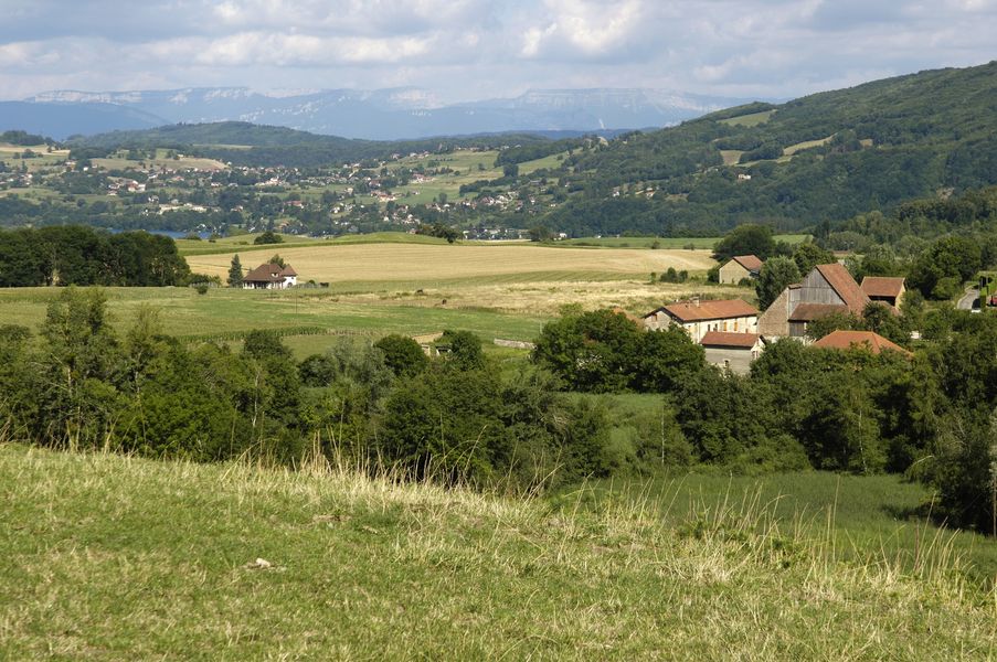
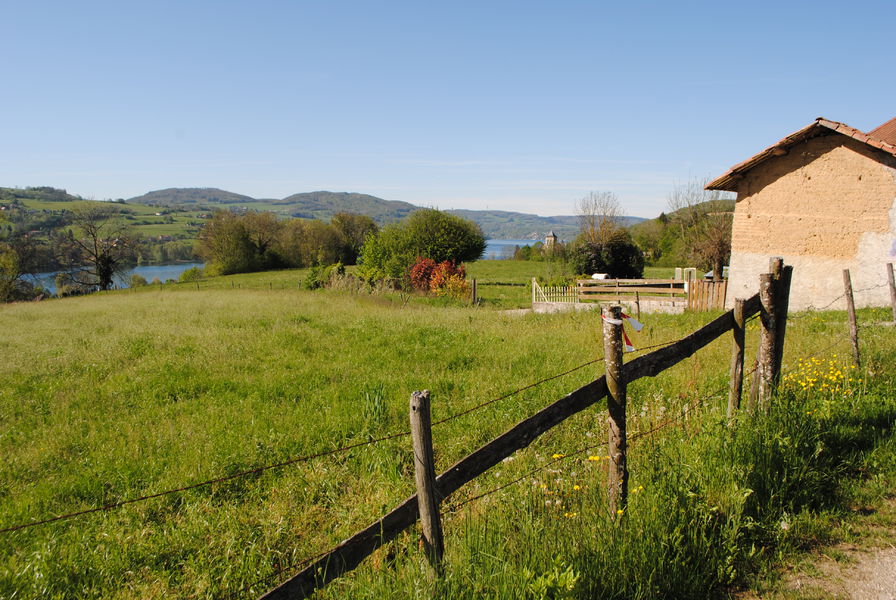
Au cœur des collines abritant le lac de Paladru, traversez les paysages transformés par les moines chartreux. C'est là qu'ils fondèrent en 1116 la Chartreuse de la Sylve Bénite.
Route labeled FFRandonnée

The characteristics of the route.

Charavines (38)
- Distance 10.1 km
- Elevation gain 190 m
- Elevation lost 190 m
- Min. elevation 493 m
- Max. elevation. 608 m
- Duration (depending on pace) 2h30
- Marking Yes
Equipments : Car park, Admission fee : Free access.Opening : All year round.
Subject to favorable weather.
Area : Pays Voironnais
Report a problem Add a comment
Website Pdf file Features of the application :
- Location and orientation on detailed maps thanks to the GPS of your smartphone
- Description of routes and points of interest on the route
- Photo gallery by route
- Detailed elevation profile
- Route tracking alert to warn you if you stray from the route
- Send predefined messages by SMS to your contacts
- Emergency module: trigger a call or send an emergency SMS in case of problem
- Agenda: access to events organized in the department
- News: find in the application the latest news on the web portal
- Adding achievements
- Add reports in case of problems encountered on the routes
- Share on social networks
Cathy_Combet
finished in 02:35:00
The 2021/04/15
En savoir plus
Ajouter votre chrono et partager vos sensations
2021/04/15 02:35:00
Cathy Combet
Cathy Combet
2021/04/15 02:35:00
Cathy Combet
Cathy Combet
Services nearby

Pays Voironnais Tourist Office, Lake Paladru information office
Charavines

Lake Paladru Archeological Museum
Villages du lac de Paladru

Espace Naturel Sensible des Marais de la Véronnière et du Courbon
Villages du lac de Paladru
Clog museum
Val-de-Virieu
Tourisme en Bièvre Est
Colombe


Information updated on 2022-10-11 by Isère Attractivité


Follow us on
the digital trails
the digital trails


![]()
The Isère Outdoor application was created
by the Département de l'Isère
Infos & contact
Conseil départemental de l'Isère
7 rue Fantin Latour
CS 41096
38 022 Grenoble cedex 1
Tel. 04 76 00 38 38


OK
Annuler