Show the map
St-Étienne de Londres - St-Laurent
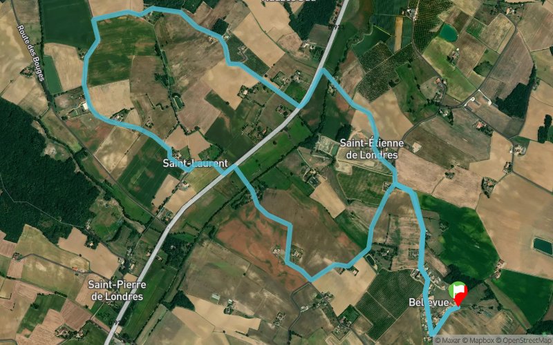


9.5 km
140 m
140 m
 Puymiclan (47)
 Points of Interest table
| Accum. | Intermediary | |||||||
|---|---|---|---|---|---|---|---|---|
| POI | Description | Alt. | Dist. | D+ | D- | Dist. | D+ | D- |
Trace n°101151
Ascent threshold : 3 m Distance threshold : 30 m Smoothing : Yes Origin of altitudes : MNT IGN
Ascent threshold : 3 m Distance threshold : 30 m Smoothing : Yes Origin of altitudes : MNT IGN
Loop
Dominant terrain : Road
Max alti. : 93 m
Avg alti. : 70 m
Min alti. : 46 m
Longest ascent : 40 m
Longest descent : 40 m
Route completed by the author : No
Dominant terrain : Road
Max alti. : 93 m
Avg alti. : 70 m
Min alti. : 46 m
Longest ascent : 40 m
Longest descent : 40 m
Route completed by the author : No
Elevation profile
More tools
Create a new roadbook page
Map and track on your website
Warning ! When you insert a Trace de Trail map on your website, you agree not to hide any element of the module (links to Trail Trail or Trail Connect banner)
Add a realisation
Validate
Add a realisation to share your chrono and describe the conditions that you encountered during you trail running !
Add a comment
Validate
Latham47
02/12/23, 16:48:29
Je cherche encore les sentiers ! Cette trace n’emprunte que du circuit routier. Bref cette trace ne présente aucun intérêt pour le trail.
02/12/23, 16:48:29
Je cherche encore les sentiers ! Cette trace n’emprunte que du circuit routier. Bref cette trace ne présente aucun intérêt pour le trail.
Show the infos
Add a track


