Show the map
Château de Longpra - Mont de Servelongue - Les Fayeux
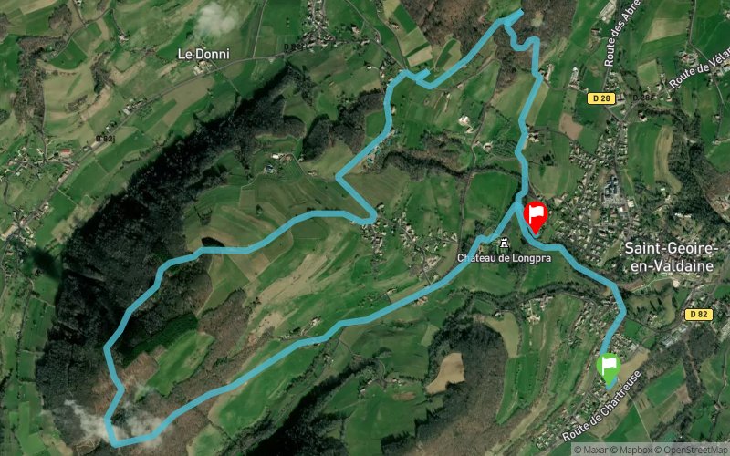


10.8 km
550 m
450 m
 Saint-Geoire-en-Valdaine (38)
 Saint-Geoire-en-Valdaine (38)
 Points of Interest table
| Accum. | Intermediary | |||||||
|---|---|---|---|---|---|---|---|---|
| POI | Description | Alt. | Dist. | D+ | D- | Dist. | D+ | D- |
Trace n°53069
Ascent threshold : 10 m Distance threshold : 0 m Smoothing : No Origin of altitudes : TrailConnect Android - GPS
Ascent threshold : 10 m Distance threshold : 0 m Smoothing : No Origin of altitudes : TrailConnect Android - GPS
Crossing
Dominant terrain : Footpath
Max alti. : 860 m
Avg alti. : 660 m
Min alti. : 453 m
Longest ascent : 390 m
Longest descent : 90 m
Route completed by the author : nc
Dominant terrain : Footpath
Max alti. : 860 m
Avg alti. : 660 m
Min alti. : 453 m
Longest ascent : 390 m
Longest descent : 90 m
Route completed by the author : nc
Elevation profile
More tools
Create a new roadbook page
Map and track on your website
Warning ! When you insert a Trace de Trail map on your website, you agree not to hide any element of the module (links to Trail Trail or Trail Connect banner)
Add a realisation
Validate
Add a realisation to share your chrono and describe the conditions that you encountered during you trail running !
Add a comment
Validate
Show the infos
Add a track


