Show the map
Solaison - Les Bouchats - Pointe d'Andey
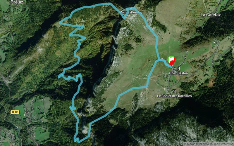


11.5 km
1194 m
1195 m
 Brizon (74)
 Points of Interest table
| Accum. | Intermediary | |||||||
|---|---|---|---|---|---|---|---|---|
| POI | Description | Alt. | Dist. | D+ | D- | Dist. | D+ | D- |
Trace n°2612
Ascent threshold : 0 m Distance threshold : 0 m Smoothing : Yes Origin of altitudes : MNT Aster GDEM
Ascent threshold : 0 m Distance threshold : 0 m Smoothing : Yes Origin of altitudes : MNT Aster GDEM
Loop
Dominant terrain : Footpath
Max alti. : 1856 m
Avg alti. : 1437 m
Min alti. : 876 m
Longest ascent : 1047 m
Longest descent : 486 m
Route completed by the author : nc
Dominant terrain : Footpath
Max alti. : 1856 m
Avg alti. : 1437 m
Min alti. : 876 m
Longest ascent : 1047 m
Longest descent : 486 m
Route completed by the author : nc
Elevation profile
More tools
Create a new roadbook page
Map and track on your website
Warning ! When you insert a Trace de Trail map on your website, you agree not to hide any element of the module (links to Trail Trail or Trail Connect banner)
Add a realisation
Validate
Add a realisation to share your chrono and describe the conditions that you encountered during you trail running !
Add a comment
Validate
Sam-Leveille
20/10/20, 10:18:33
Balisage très approximatif sur le début du parcours. Relativement dangereux si on perd la trace.... Difficile d’apprécier ce trail qui pourtant peut avoir un bel attrait avec la pointe d’Andey en point d’intérêt.
20/10/20, 10:18:33
Balisage très approximatif sur le début du parcours. Relativement dangereux si on perd la trace.... Difficile d’apprécier ce trail qui pourtant peut avoir un bel attrait avec la pointe d’Andey en point d’intérêt.
Show the infos
Add a track


